Bay of Islands, New Zealand

The Bay of Islands, is a subtropical area on the North Island of New Zealand and contains 144 islands.

This area holds a special place in New Zealand history. It was here in 1840 that the Treaty of Waitangi was signed. This is the country’s founding document signed between the local population, the Māori and the British.

The word, Māori, means one people. The Māori inhabited the east coast of New Zealand for 1,000 years, but did not come to the west coast until 100 years later. All this land is very fertile, made from volcanic stone and ash. The Māori all came from different parts of the Pacific islands, as far as the historians know, none are original to New Zealand.

We are here in early January which is part of the school holidays. In New Zealand there are 4 holidays for school students. This long one around Christmas and then 3 shorter ones spread through the year. Part of the New Zealand culture is to camp. We passed many “holiday” parks and sites to enjoy outdoor activities.

Originally there were no land mammals in New Zealand. There were only birds. But when ships started to come here to trade, rats and cats escaped from the ships. Then they brought in possums to establish a fur trade and rabbits for their fur as well. These animals have become pests, killing the native birds and overrunning the land. Currently the goal is to rid all of New Zealand of these pest animals by 2050. There are clubs in communities who set traps. They even get paid from the government when they turn in the dead animals.

Timber is one of the largest industries in New Zealand. Because of the abundant rain in this area, 3 meters a year, the trees grow very well. A pine tree can grow to full maturity in 25 years where it takes over 30 years around the world. The pine trees are used for lumber, being sent around the world and for pulp to make paper goods. Unfortunately these items are not produced here. The trees are sent to foreign countries to process from raw timber to either building wood or paper and then New Zealand imports the finished lumber and paper. You would think they would figure out a way to process the trees here.

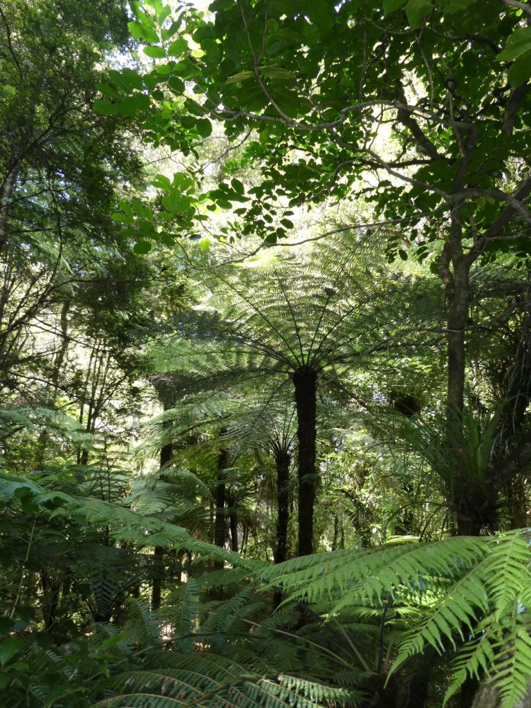
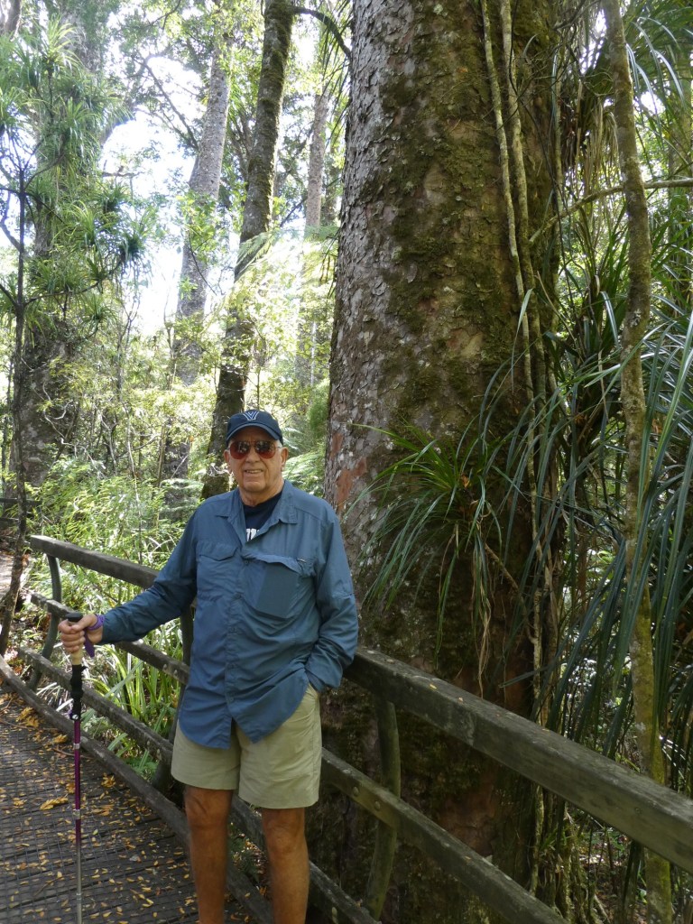
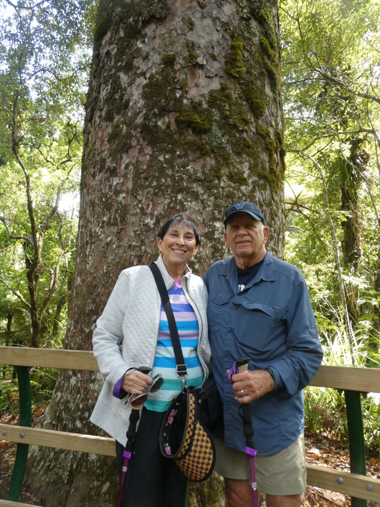
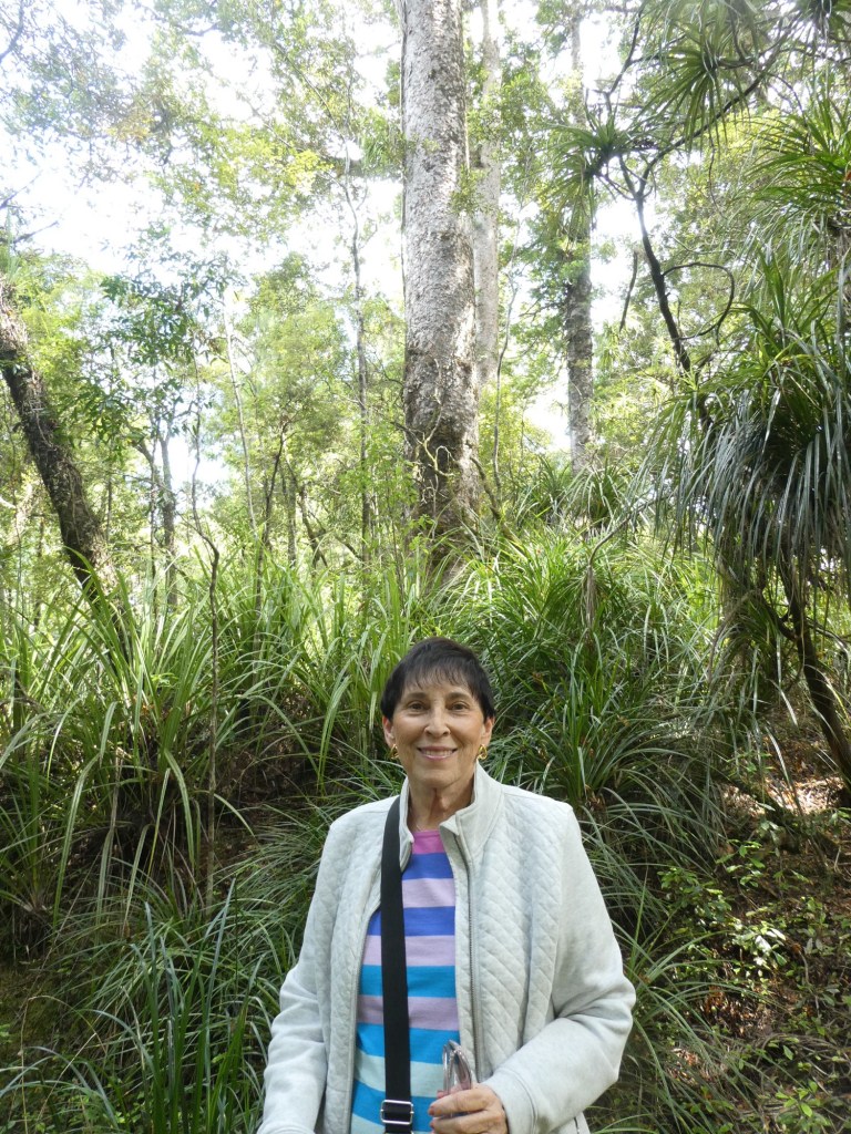
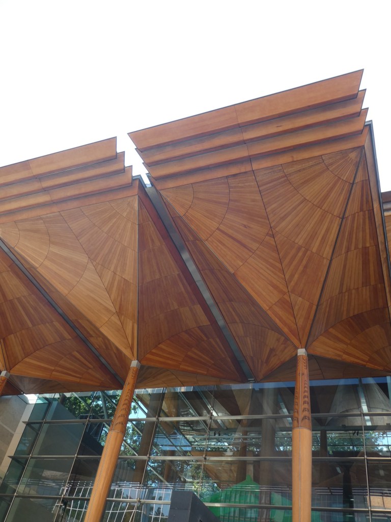
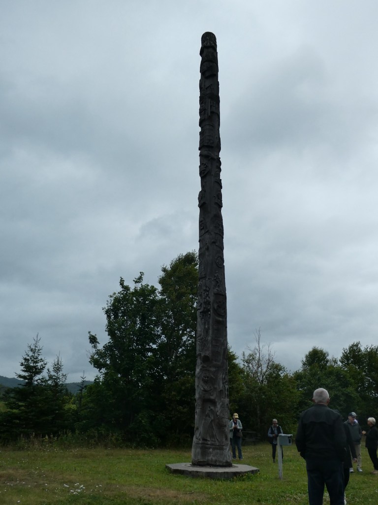
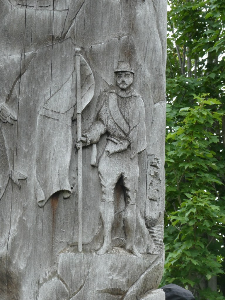
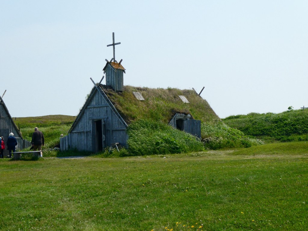
Our first stop on our tour was Puketi Forest. If you remember the wood on the museum, we came to see these trees, Kauri. Originally New Zealand was covered by these trees. They grow amazingly straight and tall. Because of this foreign traders took them down to use for sailing ship masts and wood for building. The trees are massive and the wood from them was used to build many of the original homes in San Francisco. Today only 3% of the forest exists and the trees themselves are protected as a national treasure. These trees only grow on the northern part of the north island of New Zealand. Some of the trees are 2,000 years old. They can determine their age by the girth of their trunk with 1 meter being about 500 years. We did a walk through part of the forest.

Looking up to the tree top

Our second stop was a visit to a glow worm cave. The Kawiti Glow Worm Cave is owned by a Māori family and has no government funding, something our guide was very proud of. It was discovered 350 years ago by a woman escaping from her violent husband. She lived alone in the cave for 8 months living mostly on sweet potatoes. We have no photos as they were not allowed. We walked on damp walkways and stairs, with hand held lanterns. Once we reached the center of the cave, the lanterns were extinguished and we could see the worms glowing. The area we were in held about 3,000 but the whole cave has about 15,000. Apparently there is no purpose in their life except to glow and reproduce. A glow worm lives about 365 days.

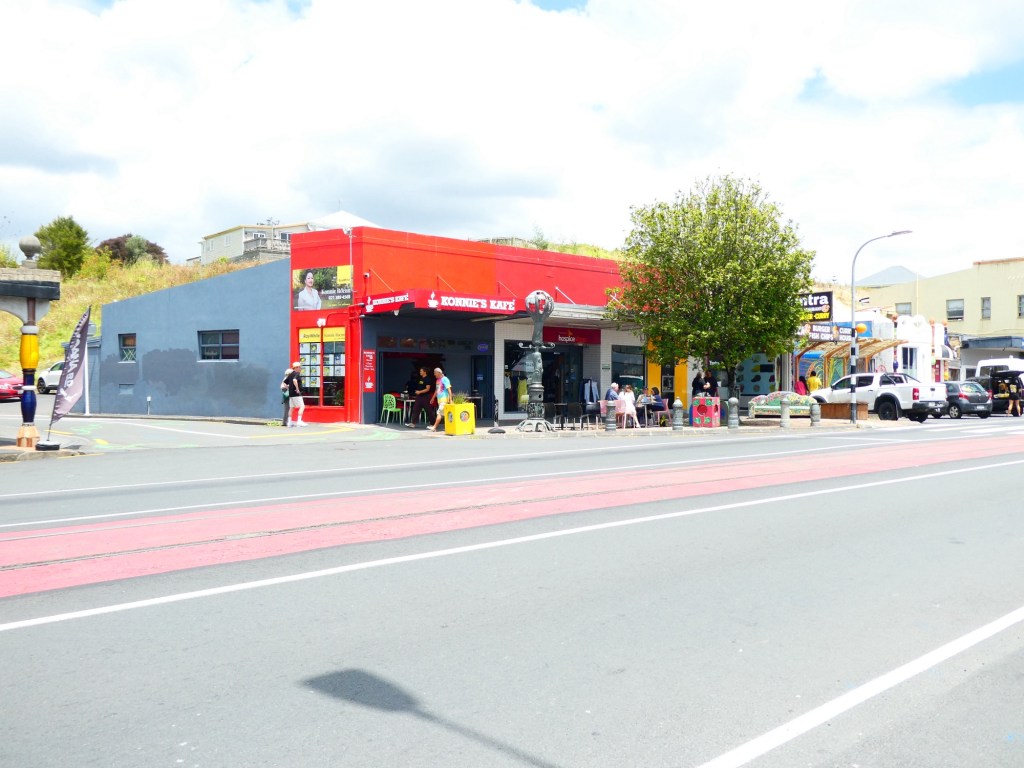
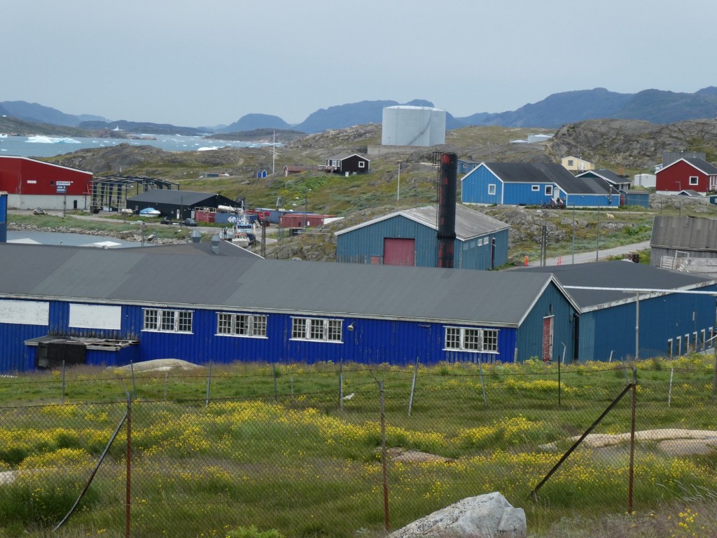
We returned to the ship after stopping in a very small town.

Our Māori glow worm guide
The very small town of Kawakawa whose claim to fame is that the railroad runs down the middle of their main stree, the red is the railroad tracks
A museum in Kawakawa

Categories: Uncategorized | Leave a comment

On to Regent Seven Seas Explorer

Today we were transferred from our hotel to our cruise ship in the morning. Because of New Zealand’s strict biodiversity laws we had lots of questions to answer and forms to show.

We boarded the ship and had lunch and then waited for our cabin to be ready. Once we got to our room, only 2 of our bags were there. Our tracker said the other bag was at a different terminal and we were concerned because there was another cruise ship leaving from that terminal. Fortunately, by the time we unpacked and got all of our clothing and stuff put away the last bag showed up. It was the one we had filled with all the things like body wash, shampoo, extra deodorants and things like that. With this trip being over 30 days, we needed extra of everything we normally bring.

We are now truly ready to get going.

Lots of views of our home away from home.

Categories: Uncategorized | 1 Comment

Auckland, New Zealand

After a good and long nights sleep we were ready to get going.

We had hired a private guide for the morning, with the intention of seeing the city of Auckland on foot and learning some history of the area and New Zealand.

Much to our disappointment our guide, Mike, was not that informative. Our hotel was in the uptown area of the city center which actually was “uptown”. It was at the top of the hill and so our tour was a slow walk down to the city center. We actually walked through a lovely park that had staircases getting us from one level to the next.

We saw some of the civic building and learned about life in New Zealand. We did talk about some current events and issues that the people who live here experience.

We stopped at a tiled mural that honored women’s suffrage. New Zealand was one of the first countries to recognize women and give them the vote.

We walked down their “high” street, where all the fancy designer stores were located. I was surprised that although it was Sunday these stores were open. At the beginning of our walk, most of the stores and restaurants were closed.

We walked along the harbor which was quite lovely. There were many restaurants and bars along the harbor’s edge. Mike told us that there had been much redevelopment in the last 10 years. The Chinese have built many of the buildings and helped to improve the downtown area and from what we saw it is quite vibrant.

We even stopped at the big fish market and saw the enormous crawfish that is caught locally. The price for 1 was $80NZD which translates to about $48USD.

Mike indicated that the cost of living is high, but the schools and healthcare are what he and his wife appreciate about living in Auckland.

A depiction of a Māori canoe at the entrance to the art museum
The wooden ceiling at the entrance to the museum made with kauri wood which is famous here in New Zealand
The Unity book store, the largest in Auckland
Part of the skyline of Auckland
The huge crawfish
Our guide, Mike

We were able to catch the hotel shuttle back so we did not have to climb the hill.

Tomorrow we board our ship for the real start of this trip.

Categories: Uncategorized | Leave a comment

New Zealand, Australia, Bali and Singapore

We started this adventure on January 8 flying from Fort Myers to Houston and then on to Auckland, New Zealand. We had fortunately booked our hotel for a day prior so our room was available as soon as we got to the hotel and although we had slept on the long flight, we were tired and slept for about 3 hours.

We went out to walk to a large park near our hotel called The Domain. It was extremely hot and humid and after seeing the duck pond came back to the hotel. There was a museum in the park, but we did not have the energy to go to it.

Street art
Ducks in the pond
More ducks in the pond

We spent the afternoon watching American football games, that is the royal we, really only Bob watched. Had a lovely dinner in the hotel bar, my pulled brisket burger with 2 different sauces was supposedly the best in Auckland, and I have to admit it was very good.

The hotel was full of Jehova Witnesses who were having their worldwide annual convention in Auckland. They were all friendly, wore costumes and, sort of like at Disney, had lanyards full of pins. There were over 3,000 in the city and our hotel was hosting about 500. All the ones we spoke to were from the United States.

We tried to stay awake until 9:30, to hopefully get onto New Zealand time, but failed. An early to bed it was.

As you can guess from the title to this post, we are going to be covering lots of ground in the next few weeks. Stay tuned.

Categories: Uncategorized | Leave a comment

Quebec City and Montreal, Canada

Our last 2 ports of call were Quebec City and then Montreal. In Quebec we had hired a private guide for a walking tour. His name was Guy (pronounced Gee) and he was wonderful. His guiding was more like having a conversation with a friend so I took very few notes. I also took very few photos. We walked on the boardwalk near the Chateau Frontenac and heard about how the city was formed.

We saw several churches, heard stories about early people who started schools for the Native People and the French communities. We heard about first the French coming and then the British. We saw the Plains of Abraham where a big battle was fought, that only lasted 10 minutes but had great impact in the development of the United States. He explained how the conflict between the French and British actually led to the establishment of our country.

We walked for 2.5 hours and then enjoyed a local lunch with him.

Hebrew in a Catholic Church
The nun who established schools in this area of Canada, part of the Ursuline order
Guy and me

In Montreal, we just grabbed a map and wandered. It turned into a hot day and we needed to pack to leave. Some photos of what we saw.

Notre Dame Basilica
Categories: Uncategorized | 1 Comment

Saguenay, Quebec, Canada

The last small town we visited was Saguenay. Unfortunately the weather was foggy and rainy so we did not see the beautiful scenery as we sailed in or out of the fjord and river named Saguenay. I had been here in September on a cruise and a post about Saguenay can be found at bsbat.wordpress.com.

Saguenay is the largest city in area in Quebec. It is the merger of 7 cities about 15 years ago. They could not agree on what to call the combined city so they took the name of the fjord, river and national park. The population of the area is about 125,000.

The bay is called (in native language) Aha Bay which means dead end. In 1996 there were many days of rain which caused the dams to overflow and flood the town, washing away homes, roads and other infrastructure.

Our tour was about craftsmen in the area. Our first stop was at a glass blower’s studio. He did 2 pieces while we watched. One was a ball with an intricate inner design and the second was a hummingbird. We then had time to shop in his gallery. He had been doing this for 35 years.

When we arrived it was low tide

Our second stop was at a fromagerie. The family had been in the cheese making business for 39 years. It started as a side business for the family when they made excess cheese and sold it to neighbors. The current business employs 125 people and they produce cheese 7 days a week, 24 hours a day. They produce cheddar cheeses and we got to taste 6 types. Their store was packed with locals buying cheese.

My plate of cheeses we samples

Our last stop was at an alpaca farm, where they raise alpacas and then use the wool to make products. We saw a movie about alpacas, where they originated and how their wool is different from sheep and other animals. They had pretty products for sale, but who needs more wool items when you live in Florida.

Some facts we learned about the area:

  1. The area was settled in the late 1600s for fur trade.
  2. The tides range up to 9 feet from low to high tide.
  3. The bay freezes in the winter and when the ice is 12 inches thick people put ice houses out to fish through the ice, or as our guide said to drink beer. They actually create streets on the ice and the city plows them so you can drive to your ice house.
  4. The Price family ( these folks were mentioned in many of the places we stopped) arrived and developed pulp mills, built dams for power.
  5. The industrialist Arthur Vining Davis came to the area developing a planned city called Arvida ( first 2 letters of his names), aluminum production, dams and other infrastructure. In 1926 he had the largest aluminum plant in the world.
  6. Surprisingly there were many above ground swimming pools at private homes we passed.
  7. The town has a large military base. It is part of NORAD and they always have a F18 fighter jet ready to lift off in no more than 5 minutes.
  8. 95% of the population only speak French.
  9. The fjord is 60 miles long and has both fresh and salt water. At points it is 1,000 feet deep and the cliffs rise 1,000 feet on either side.
  10. Daycare costs $8.10 per child per day!
  11. The town has 2 colleges, one for pilot training and one for media training.
In the afternoon
Kids actually in the cold water, brrrrr
Categories: Uncategorized | Leave a comment

There are a lot of Small Towns in Canada

The next town we went to in Newfoundland was Corner Brook. Corner Brook became a city in 1956 and has a current population of 20,000. The area population is around 40,000. The city is surrounded by mountains and they are part of the Appalachian Mountain belt. Most people are employed by the hospital system or the pulp and paper mill. There are 3 college campuses in the area.

The Humber River runs along the edge of town and is fished for the Atlantic salmon. Atlantic salmon are multi year salmon, they do not die after they spawn. Our first stop was to see The Man in the Mountain, a face in the side of the mountain. Fortunately our guide had a photo to show us where to look to see the face. Once you see it, it is easy to see, but trying to look on your own is not easy to find it.

Our next stop was at the Marble Mountain Ski area to see the Heritage Tree. It is 50 feet tall and carved with many designs telling the story of the area from the oldest of times. It was erected during Canada’s centennial.

We then went to the Captain James Cook Monument. In 1767, the famous British explorer and cartographer surveyed the Bay of Islands and was the first to map the area. His maps were so accurate that they were used until the 20th century. He also sailed the world and mapped many other areas.

Our final stop in Corner Brook was at the Margaret Bowater Park. The park is an oasis in the center of the city with playgrounds, walking/hiking trails and a natural swimming pool made by damming the river that runs through the park. It was donated to the city by Sir Edward Bowater who owned the paper mill and named for his daughter.

The natural swimming pool (water temperature, cold)

Our next small city was Sept-Íles which is in the province of Quebec. It was named by Jacques Cartier, a French explorer. The main source of industry is iron, either the manufacture of or the transportation of. Because of this they built a huge seaport and the town grew quickly because of all the work done in building that and then for the production of iron products. The population of the city is about 28,000. The town of Sept-Íles did not get electricity until 1947.

Our tour centered on the combining of the Native people and the explorers from France and then England. The Native people were either Innu or Inuit. They used the rivers in the area to travel between their summer homes along the river and their winter homes in the mountains.

We stopped at a garden/park along the river to see what the landscape was like.

Then we went to the museum that told the story of how the Native People lived. We saw representations of how each season was used in their lives. There was also a movie that showed them hunting for caribou and then using their skills to use every part of the animal. We saw fishing techniques and finally a meeting of various families that occurs each spring when they come down from the mountains and camp by the rivers. Our guide in the museum was a young man who was interesting to listen to. After his talk, I asked if there were many who still lived in the traditional ways and he said no, not many. It is sad that this way will be lost, but the schools in the area teach the native languages so that part of the culture will not be lost.

A snow shoe made from caribou parts
A full sized canoe

Our last stop was at the recreation of the Old Trading Post. In 1673, the French came to the area and established a series of trading posts in this area, calling it New France. Eventually the French were conquered by the British around 1759. These posts were all part of the Hudson Bay Company, which actually closed down this year. The trading was beneficial to both the Europeans and the Native People. The Native people were able to trade their furs, the beaver being the most valuable fur, and getting in return tools made with iron, like hatchets, knives, cooking pots and even foods. The furs were highly coveted in Europe by the rich for their extravagant clothing, hats and shoes.

Some hunting implements made from wood and caribou bones
A bale of furs
Items sold at a trading post

At the entrance to the port where our ship was anchored was this metal sculpture of a whale. It was filled with plastic goods, to encourage people to be more careful of the oceans, rivers and other waterways.

Categories: Uncategorized | Leave a comment

Saint Anthony, Newfoundland, Canada

The day started with bright sun and warmish temperatures. We had an excursion to go to L’Anse aux Meadows National Historic Park. It is a UNESCO World Heritage Site and is believed to be the first European settlement in North America.

Saint Anthony is on the northern tip of the island part of Newfoundland. It is part of the Viking Trail. It is also famous for having huge icebergs floating in the bays and harbors and there is a big festival in June to celebrate their arrival. We did not see any icebergs on our visit.

We learned about Dr. Wilfred Grenfell, who came to this area in the early part of the 19th century. He built hospitals, schools and orphanages to help the poor native Inuit and European settlers. There was a museum dedicated to him and what he did to help build the community.

The town of Saint Anthony has a population of 2,000. It used to be a fishing village, but with different rules and regulations fishing has been pushed aside as the main way to earn a living. Now the hospital is the largest employer. There are over 100,000 moose in Newfoundland. People hunt them as well as caribou, black bears and seals. When hunted all parts of the animal is used. The hunting is not for sport.

Along the roadside were huge piles of cut wood. We learned that many people in this area use wood stoves for warmth and even cooking. They can get a permit to cut wood for $25 and people are respectful of the already cut wood and don’t take it.

As we drove, there were many coves and lakes.

When we reach the park, we were able to walk through seeing the remains of the original Viking settlement. There were some structures that had been recreated.

Sod house

We then boarded our school bus (no fancy coaches here) and drove about 3 minutes to a locally sponsored site called, Norstead. It was a site that had reenactment of Viking times. There was a Viking boat replica. Various buildings with a blacksmith, weavers, potters and even ax throwing.

The church
Blacksmith

As you can see from the photos, we had a lovely sunny day, but very windy.

Categories: Uncategorized | Leave a comment

Catching up

A few days ago we arrived in our second port in Greenland, Paamiut. It was another tender port. When we looked out of our windows we saw that we were very far from the town. In addition it was very windy and cold and pouring rain. We opted to not go ashore.

We had a short stay there with the morning excursions cancelled. In addition, because a cargo ship was in port and had to leave, we were told to leave as well. I am sure it was disappointing for those with tour tickets, but we were fine having what seemed like a sea day. We took advantage of the time to go to one of the lectures.

Our next day was the port of Nuuk, Greenland. We had a tour, but it was exceptionally foggy, so the views were were supposed to be seeing were not that easy to see. Our guide was a 20 year old college student. She studies in Denmark, but comes back to Nuuk in the summer to be with her family. Nuuk is divided into 3 parts. The buildings are very colorful. In the old days the colors of the buildings indicated what they were used as. For example, yellow was medical, red was a school and blue was shops.

The population of Greenland is mostly Christian. The total population of Greenland is about 56,000 and Nuuk, the capital, has a population of about 20,000. There were even traffic signals! Fishing is still a major industry, but the town has large industrial areas as well. Most of their electricity is water powered. The weather here is very harsh. Most of their food has to be brought in by ship. Most people hunt or fish to provide food for their families. Most families have boats but not all have cars. There are no roads that connect the cities so to get around you need a boat.

All the political parties of Greenland are against becoming part of the United States. In addition, they are a protectate of Denmark, not owned by Denmark. Our guide said that they want to be their own country, but do not have the financial resources to do that.

Some of the sites we visited was the old harbor where we saw the Mother of the Sea statue. All of the city, with the newest area often being cut off in winter by snow on the road. The new international airport and the main cemetery and University. We passed by the prison, which allows the prisoners to go out during the day. Our guide said that they are trying to rehabilitate the prisoners, not punish them. Most of their crimes are minor, drugs or family related offenses. Serious offenders are sent to prison in Denmark.

One of the harbors

When got back on the ship, all the pool furniture had been lashed down because we were going to be sailing in bad weather. Even some of the furniture in our suite was tied down.

Our next day was a sea day. It was terribly rough and both of us were under the weather. We spent most of the day in our suite and had what little we were able to eat brought in. I took the following video from the TV bridge cam.

We were glad when we got out of the very heavy weather.

Categories: Uncategorized | Leave a comment

Narsaq, Greenland

Our first port of call in Greenland is Narsaq. We did not book an excursion here, so we took the tender into town. The only information I have is from the ship’s newspaper about the port. Narsaq offers a rich blend of Norse history and southern Greenlandic landscapes. It is located between 2 fjords and offers hiking, boating and other outdoor activities. This area has some of the rarest of earth minerals. The town is full of colorful buildings.

The museum
The neck piece is all beadwork
What we saw this morning

We went to the Narsaq museum, which housed clothing made from various animal skins. There were several buildings to the museum, but we only saw one. Basically because we could not find the others. No map of the town.

Most importantly the water surrounding us was filled with amazing icebergs.

Video of what we saw when we woke up this morning

I am now sitting in my room, watching icebergs float past us.

These 3 just floated into view

Categories: Uncategorized | Leave a comment

Blog at WordPress.com.