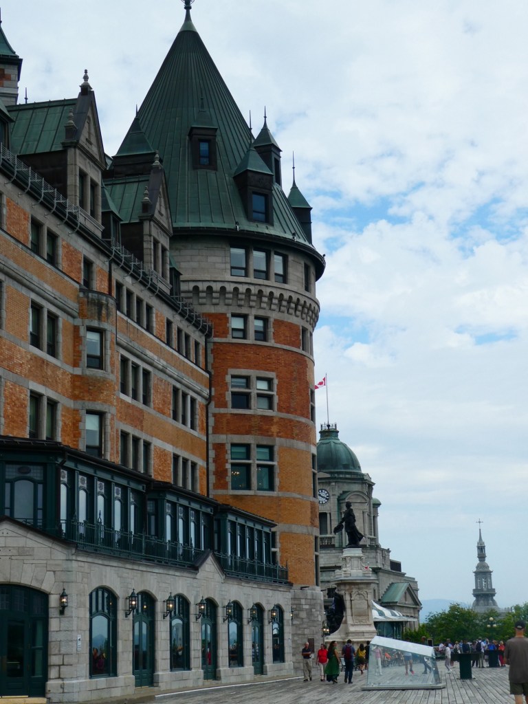
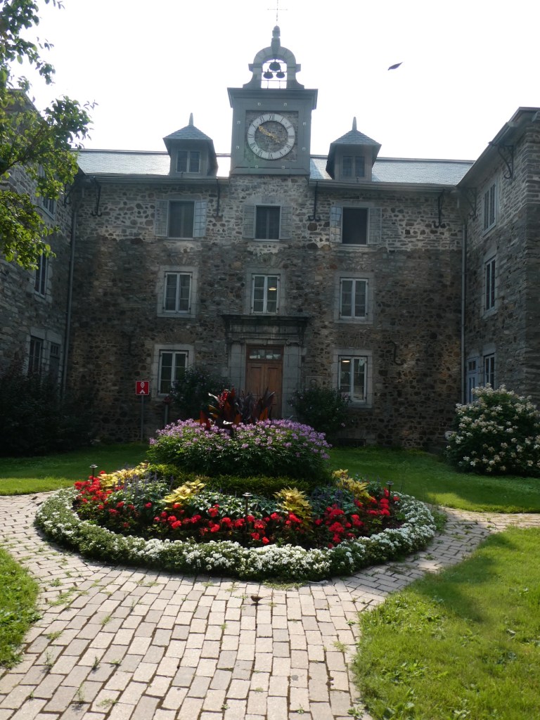
Our last 2 ports of call were Quebec City and then Montreal. In Quebec we had hired a private guide for a walking tour. His name was Guy (pronounced Gee) and he was wonderful. His guiding was more like having a conversation with a friend so I took very few notes. I also took very few photos. We walked on the boardwalk near the Chateau Frontenac and heard about how the city was formed.
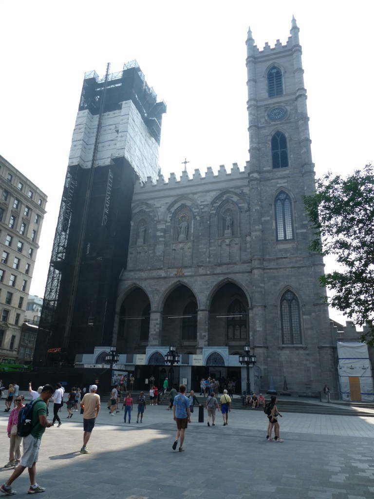
We saw several churches, heard stories about early people who started schools for the Native People and the French communities. We heard about first the French coming and then the British. We saw the Plains of Abraham where a big battle was fought, that only lasted 10 minutes but had great impact in the development of the United States. He explained how the conflict between the French and British actually led to the establishment of our country.
We walked for 2.5 hours and then enjoyed a local lunch with him.
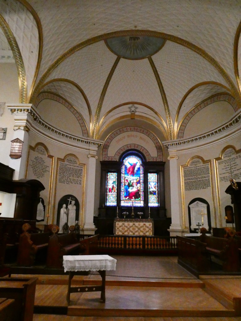
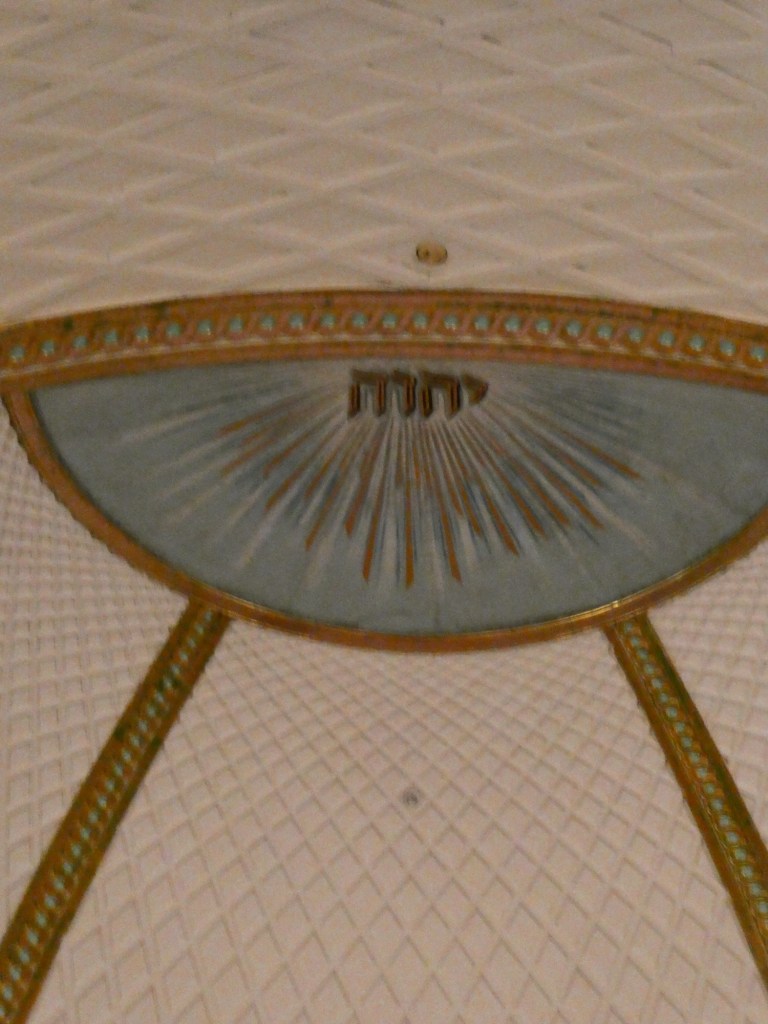
Hebrew in a Catholic Church The nun who established schools in this area of Canada, part of the Ursuline orderGuy and me
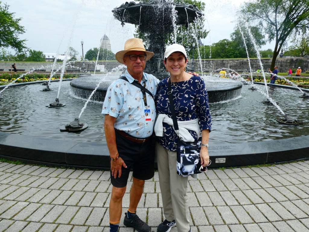
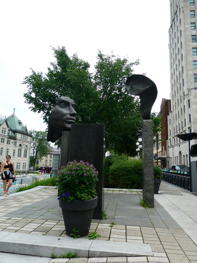
In Montreal, we just grabbed a map and wandered. It turned into a hot day and we needed to pack to leave. Some photos of what we saw.
The last small town we visited was Saguenay. Unfortunately the weather was foggy and rainy so we did not see the beautiful scenery as we sailed in or out of the fjord and river named Saguenay. I had been here in September on a cruise and a post about Saguenay can be found at bsbat.wordpress.com.
Saguenay is the largest city in area in Quebec. It is the merger of 7 cities about 15 years ago. They could not agree on what to call the combined city so they took the name of the fjord, river and national park. The population of the area is about 125,000.
The bay is called (in native language) Aha Bay which means dead end. In 1996 there were many days of rain which caused the dams to overflow and flood the town, washing away homes, roads and other infrastructure.
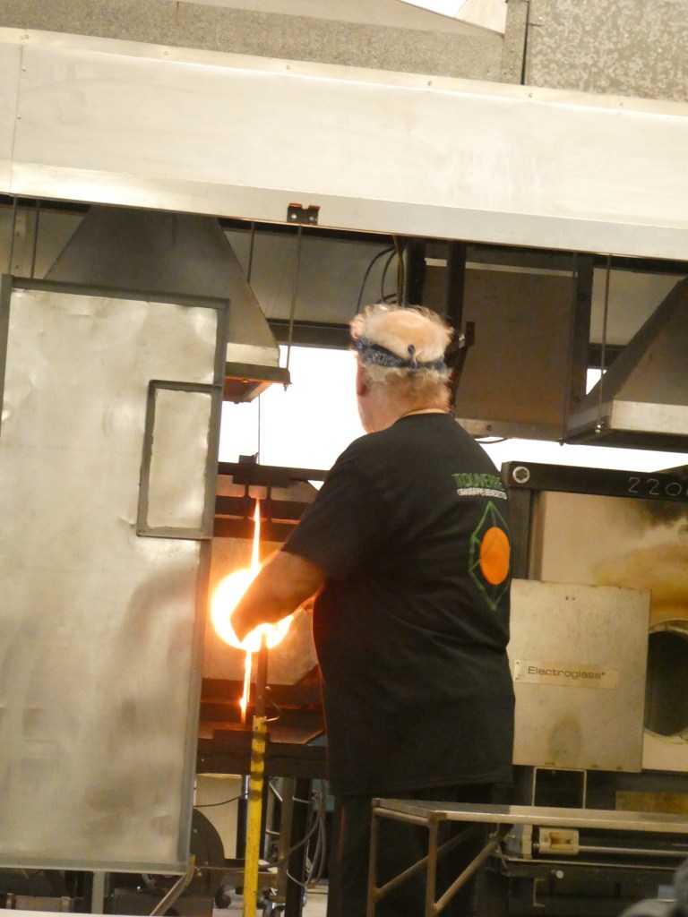
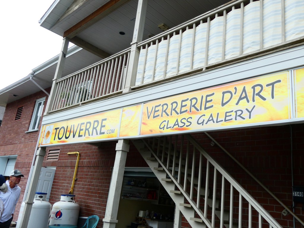
Our tour was about craftsmen in the area. Our first stop was at a glass blower’s studio. He did 2 pieces while we watched. One was a ball with an intricate inner design and the second was a hummingbird. We then had time to shop in his gallery. He had been doing this for 35 years.
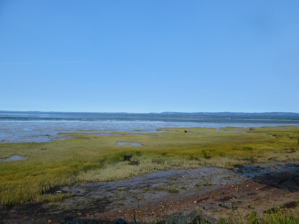
When we arrived it was low tide
Our second stop was at a fromagerie. The family had been in the cheese making business for 39 years. It started as a side business for the family when they made excess cheese and sold it to neighbors. The current business employs 125 people and they produce cheese 7 days a week, 24 hours a day. They produce cheddar cheeses and we got to taste 6 types. Their store was packed with locals buying cheese.
My plate of cheeses we samples
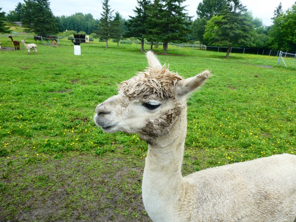
Our last stop was at an alpaca farm, where they raise alpacas and then use the wool to make products. We saw a movie about alpacas, where they originated and how their wool is different from sheep and other animals. They had pretty products for sale, but who needs more wool items when you live in Florida.
Some facts we learned about the area:
The area was settled in the late 1600s for fur trade.
The tides range up to 9 feet from low to high tide.
The bay freezes in the winter and when the ice is 12 inches thick people put ice houses out to fish through the ice, or as our guide said to drink beer. They actually create streets on the ice and the city plows them so you can drive to your ice house.
The Price family ( these folks were mentioned in many of the places we stopped) arrived and developed pulp mills, built dams for power.
The industrialist Arthur Vining Davis came to the area developing a planned city called Arvida ( first 2 letters of his names), aluminum production, dams and other infrastructure. In 1926 he had the largest aluminum plant in the world.
Surprisingly there were many above ground swimming pools at private homes we passed.
The town has a large military base. It is part of NORAD and they always have a F18 fighter jet ready to lift off in no more than 5 minutes.
95% of the population only speak French.
The fjord is 60 miles long and has both fresh and salt water. At points it is 1,000 feet deep and the cliffs rise 1,000 feet on either side.
Daycare costs $8.10 per child per day!
The town has 2 colleges, one for pilot training and one for media training.
In the afternoon Kids actually in the cold water, brrrrr
The next town we went to in Newfoundland was Corner Brook. Corner Brook became a city in 1956 and has a current population of 20,000. The area population is around 40,000. The city is surrounded by mountains and they are part of the Appalachian Mountain belt. Most people are employed by the hospital system or the pulp and paper mill. There are 3 college campuses in the area.
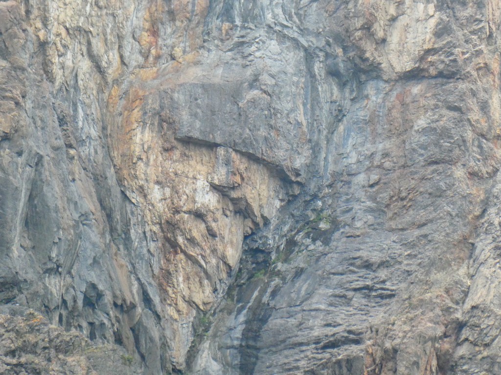
The Humber River runs along the edge of town and is fished for the Atlantic salmon. Atlantic salmon are multi year salmon, they do not die after they spawn. Our first stop was to see The Man in the Mountain, a face in the side of the mountain. Fortunately our guide had a photo to show us where to look to see the face. Once you see it, it is easy to see, but trying to look on your own is not easy to find it.
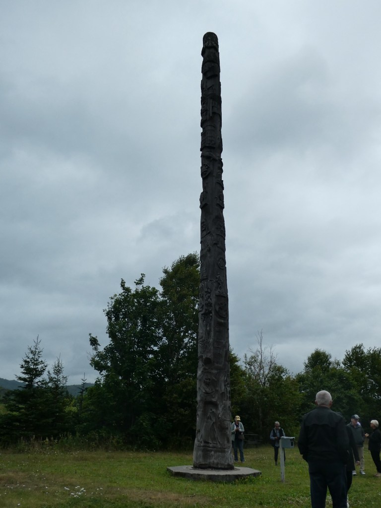
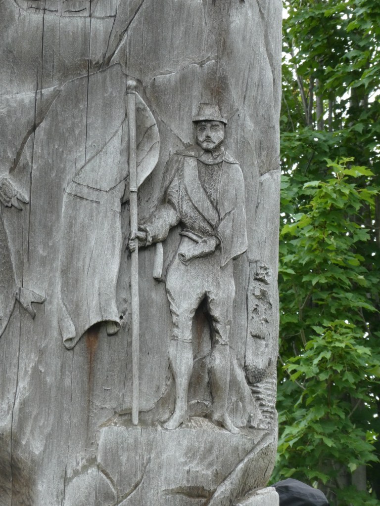
Our next stop was at the Marble Mountain Ski area to see the Heritage Tree. It is 50 feet tall and carved with many designs telling the story of the area from the oldest of times. It was erected during Canada’s centennial.
We then went to the Captain James Cook Monument. In 1767, the famous British explorer and cartographer surveyed the Bay of Islands and was the first to map the area. His maps were so accurate that they were used until the 20th century. He also sailed the world and mapped many other areas.
Our final stop in Corner Brook was at the Margaret Bowater Park. The park is an oasis in the center of the city with playgrounds, walking/hiking trails and a natural swimming pool made by damming the river that runs through the park. It was donated to the city by Sir Edward Bowater who owned the paper mill and named for his daughter.
The natural swimming pool (water temperature, cold)
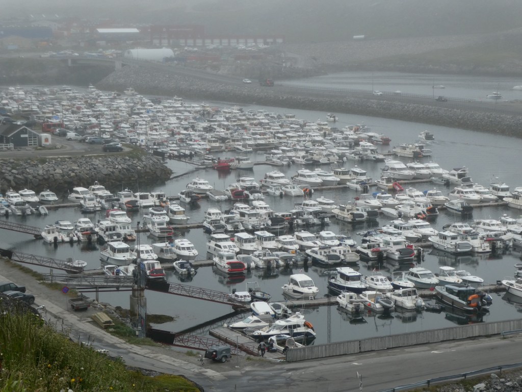
Our next small city was Sept-Íles which is in the province of Quebec. It was named by Jacques Cartier, a French explorer. The main source of industry is iron, either the manufacture of or the transportation of. Because of this they built a huge seaport and the town grew quickly because of all the work done in building that and then for the production of iron products. The population of the city is about 28,000. The town of Sept-Íles did not get electricity until 1947.
Our tour centered on the combining of the Native people and the explorers from France and then England. The Native people were either Innu or Inuit. They used the rivers in the area to travel between their summer homes along the river and their winter homes in the mountains.
We stopped at a garden/park along the river to see what the landscape was like.
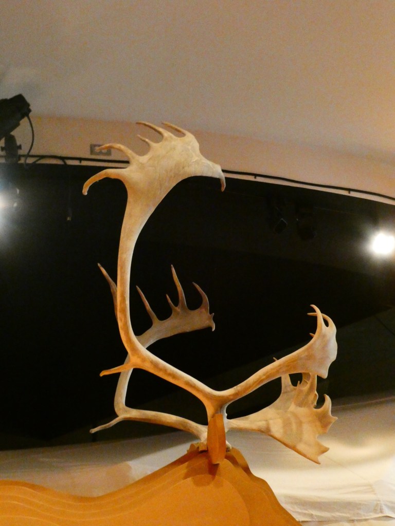
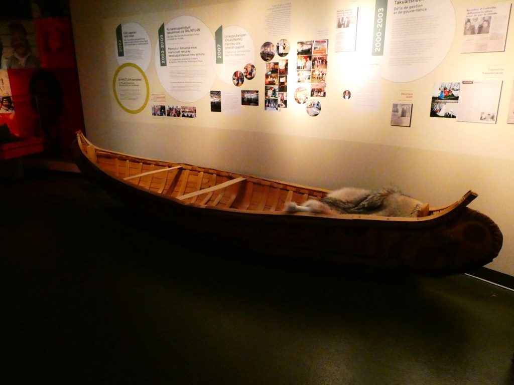
Then we went to the museum that told the story of how the Native People lived. We saw representations of how each season was used in their lives. There was also a movie that showed them hunting for caribou and then using their skills to use every part of the animal. We saw fishing techniques and finally a meeting of various families that occurs each spring when they come down from the mountains and camp by the rivers. Our guide in the museum was a young man who was interesting to listen to. After his talk, I asked if there were many who still lived in the traditional ways and he said no, not many. It is sad that this way will be lost, but the schools in the area teach the native languages so that part of the culture will not be lost.
A snow shoe made from caribou partsA full sized canoe
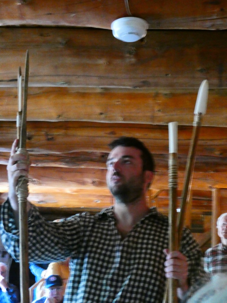
Our last stop was at the recreation of the Old Trading Post. In 1673, the French came to the area and established a series of trading posts in this area, calling it New France. Eventually the French were conquered by the British around 1759. These posts were all part of the Hudson Bay Company, which actually closed down this year. The trading was beneficial to both the Europeans and the Native People. The Native people were able to trade their furs, the beaver being the most valuable fur, and getting in return tools made with iron, like hatchets, knives, cooking pots and even foods. The furs were highly coveted in Europe by the rich for their extravagant clothing, hats and shoes.
Some hunting implements made from wood and caribou bonesA bale of fursItems sold at a trading post
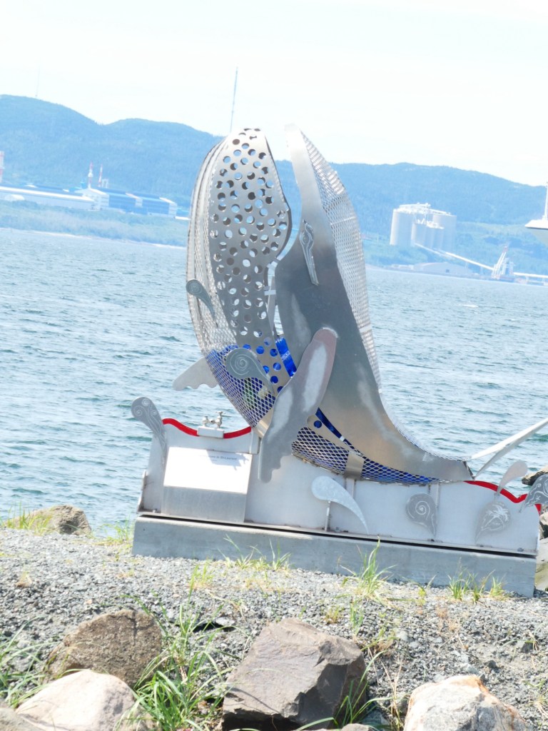
At the entrance to the port where our ship was anchored was this metal sculpture of a whale. It was filled with plastic goods, to encourage people to be more careful of the oceans, rivers and other waterways.
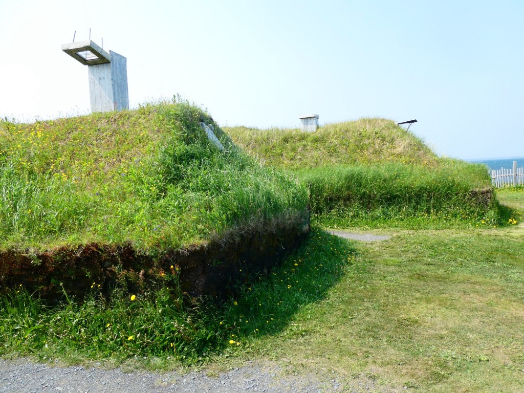
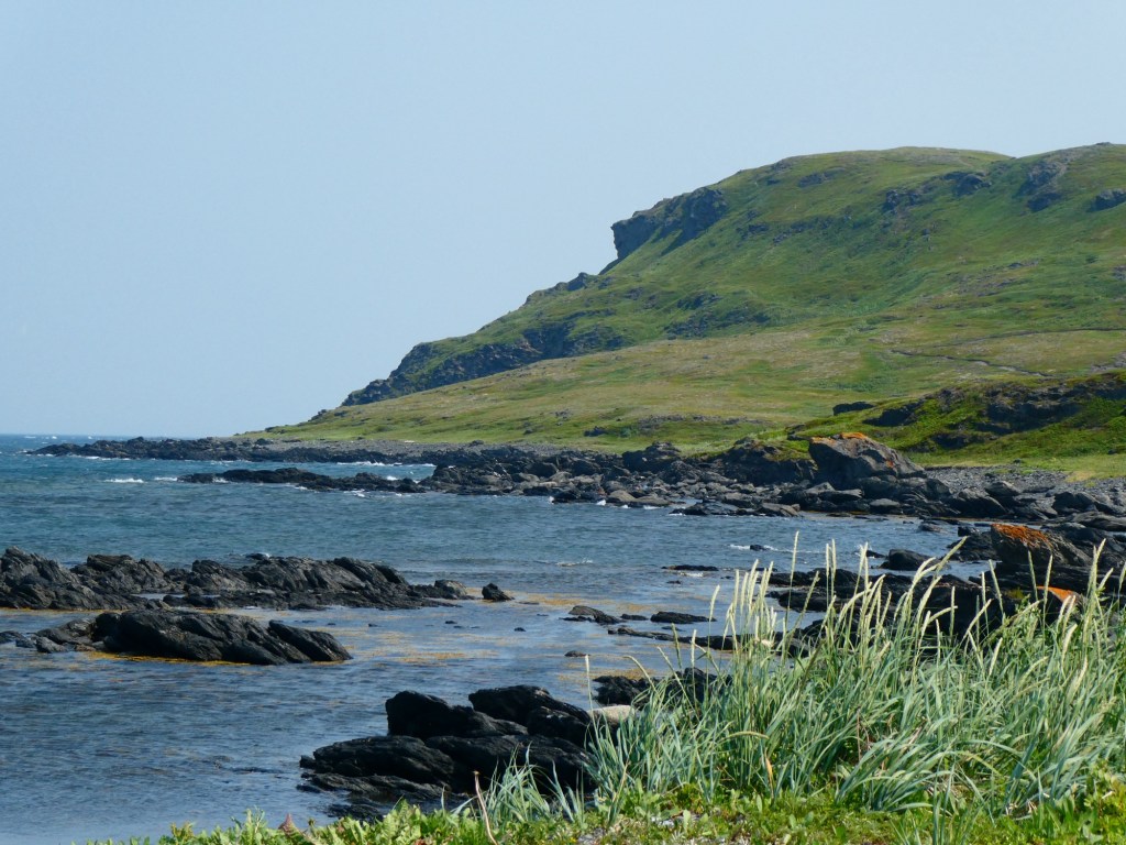
The day started with bright sun and warmish temperatures. We had an excursion to go to L’Anse aux Meadows National Historic Park. It is a UNESCO World Heritage Site and is believed to be the first European settlement in North America.
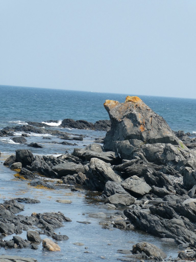
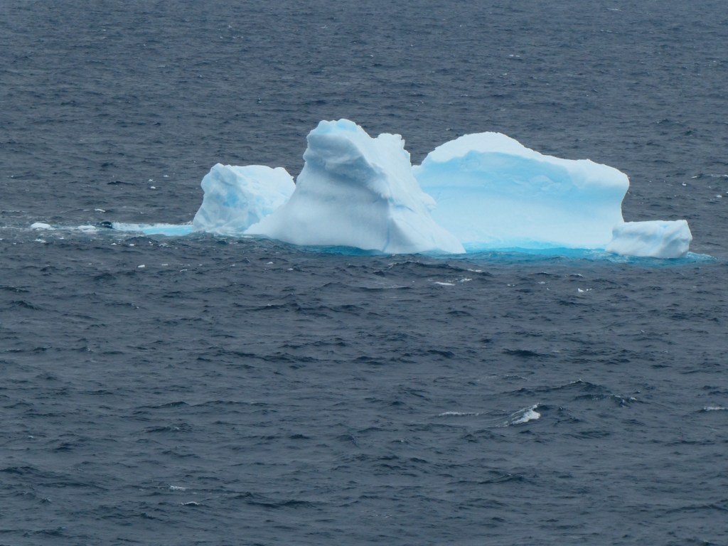
Saint Anthony is on the northern tip of the island part of Newfoundland. It is part of the Viking Trail. It is also famous for having huge icebergs floating in the bays and harbors and there is a big festival in June to celebrate their arrival. We did not see any icebergs on our visit.
We learned about Dr. Wilfred Grenfell, who came to this area in the early part of the 19th century. He built hospitals, schools and orphanages to help the poor native Inuit and European settlers. There was a museum dedicated to him and what he did to help build the community.
The town of Saint Anthony has a population of 2,000. It used to be a fishing village, but with different rules and regulations fishing has been pushed aside as the main way to earn a living. Now the hospital is the largest employer. There are over 100,000 moose in Newfoundland. People hunt them as well as caribou, black bears and seals. When hunted all parts of the animal is used. The hunting is not for sport.
Along the roadside were huge piles of cut wood. We learned that many people in this area use wood stoves for warmth and even cooking. They can get a permit to cut wood for $25 and people are respectful of the already cut wood and don’t take it.
As we drove, there were many coves and lakes.
When we reach the park, we were able to walk through seeing the remains of the original Viking settlement. There were some structures that had been recreated.
Sod house
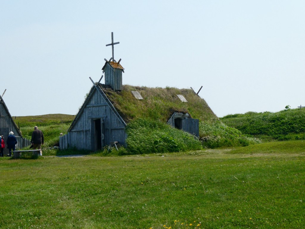
We then boarded our school bus (no fancy coaches here) and drove about 3 minutes to a locally sponsored site called, Norstead. It was a site that had reenactment of Viking times. There was a Viking boat replica. Various buildings with a blacksmith, weavers, potters and even ax throwing.
The churchBlacksmith
As you can see from the photos, we had a lovely sunny day, but very windy.
A few days ago we arrived in our second port in Greenland, Paamiut. It was another tender port. When we looked out of our windows we saw that we were very far from the town. In addition it was very windy and cold and pouring rain. We opted to not go ashore.
We had a short stay there with the morning excursions cancelled. In addition, because a cargo ship was in port and had to leave, we were told to leave as well. I am sure it was disappointing for those with tour tickets, but we were fine having what seemed like a sea day. We took advantage of the time to go to one of the lectures.
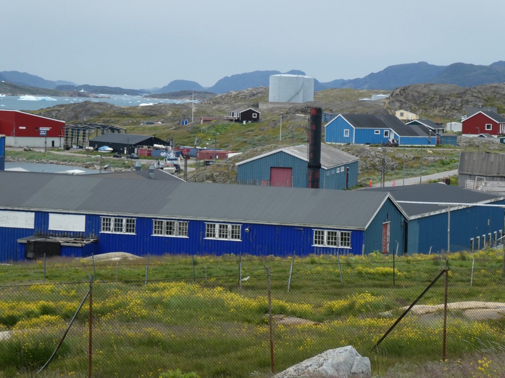
Our next day was the port of Nuuk, Greenland. We had a tour, but it was exceptionally foggy, so the views were were supposed to be seeing were not that easy to see. Our guide was a 20 year old college student. She studies in Denmark, but comes back to Nuuk in the summer to be with her family. Nuuk is divided into 3 parts. The buildings are very colorful. In the old days the colors of the buildings indicated what they were used as. For example, yellow was medical, red was a school and blue was shops.
The population of Greenland is mostly Christian. The total population of Greenland is about 56,000 and Nuuk, the capital, has a population of about 20,000. There were even traffic signals! Fishing is still a major industry, but the town has large industrial areas as well. Most of their electricity is water powered. The weather here is very harsh. Most of their food has to be brought in by ship. Most people hunt or fish to provide food for their families. Most families have boats but not all have cars. There are no roads that connect the cities so to get around you need a boat.
All the political parties of Greenland are against becoming part of the United States. In addition, they are a protectate of Denmark, not owned by Denmark. Our guide said that they want to be their own country, but do not have the financial resources to do that.
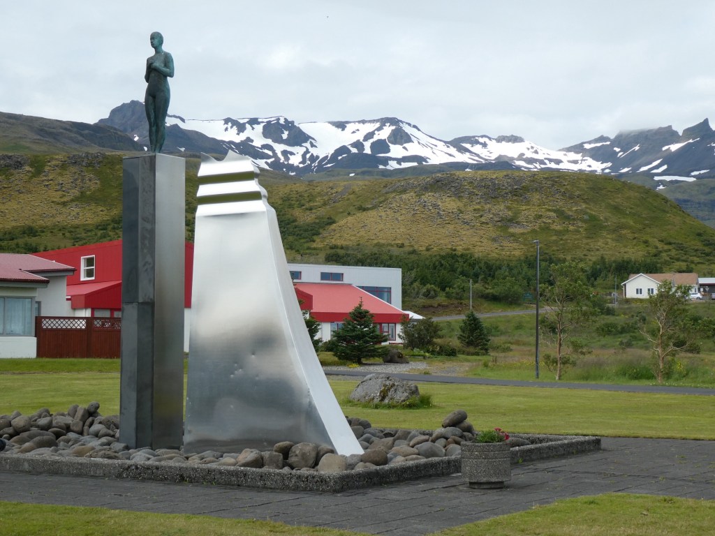
Some of the sites we visited was the old harbor where we saw the Mother of the Sea statue. All of the city, with the newest area often being cut off in winter by snow on the road. The new international airport and the main cemetery and University. We passed by the prison, which allows the prisoners to go out during the day. Our guide said that they are trying to rehabilitate the prisoners, not punish them. Most of their crimes are minor, drugs or family related offenses. Serious offenders are sent to prison in Denmark.
One of the harbors
When got back on the ship, all the pool furniture had been lashed down because we were going to be sailing in bad weather. Even some of the furniture in our suite was tied down.
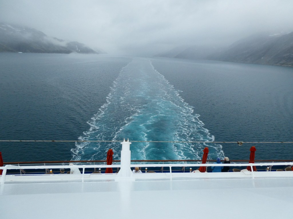
Our next day was a sea day. It was terribly rough and both of us were under the weather. We spent most of the day in our suite and had what little we were able to eat brought in. I took the following video from the TV bridge cam.
We were glad when we got out of the very heavy weather.
Our first port of call in Greenland is Narsaq. We did not book an excursion here, so we took the tender into town. The only information I have is from the ship’s newspaper about the port. Narsaq offers a rich blend of Norse history and southern Greenlandic landscapes. It is located between 2 fjords and offers hiking, boating and other outdoor activities. This area has some of the rarest of earth minerals. The town is full of colorful buildings.
The museumThe neck piece is all beadworkWhat we saw this morning
We went to the Narsaq museum, which housed clothing made from various animal skins. There were several buildings to the museum, but we only saw one. Basically because we could not find the others. No map of the town.
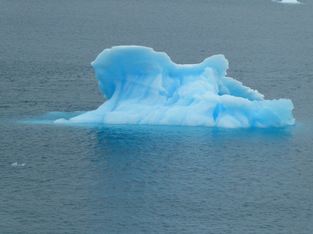
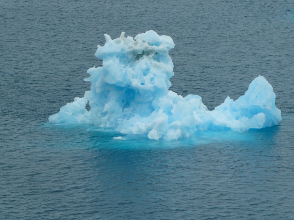
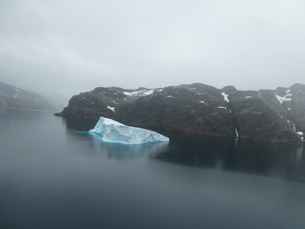
Most importantly the water surrounding us was filled with amazing icebergs.
Video of what we saw when we woke up this morning
I am now sitting in my room, watching icebergs float past us.
We are at the end of two sea days. Our first one was spent sailing the Sea of Labrador. We had a calm and sunny day. Nothing to see just water in every direction. We played bridge in a duplicate game in the afternoon and for those of you who will understand the next statement, we had a 79.6% game!!!
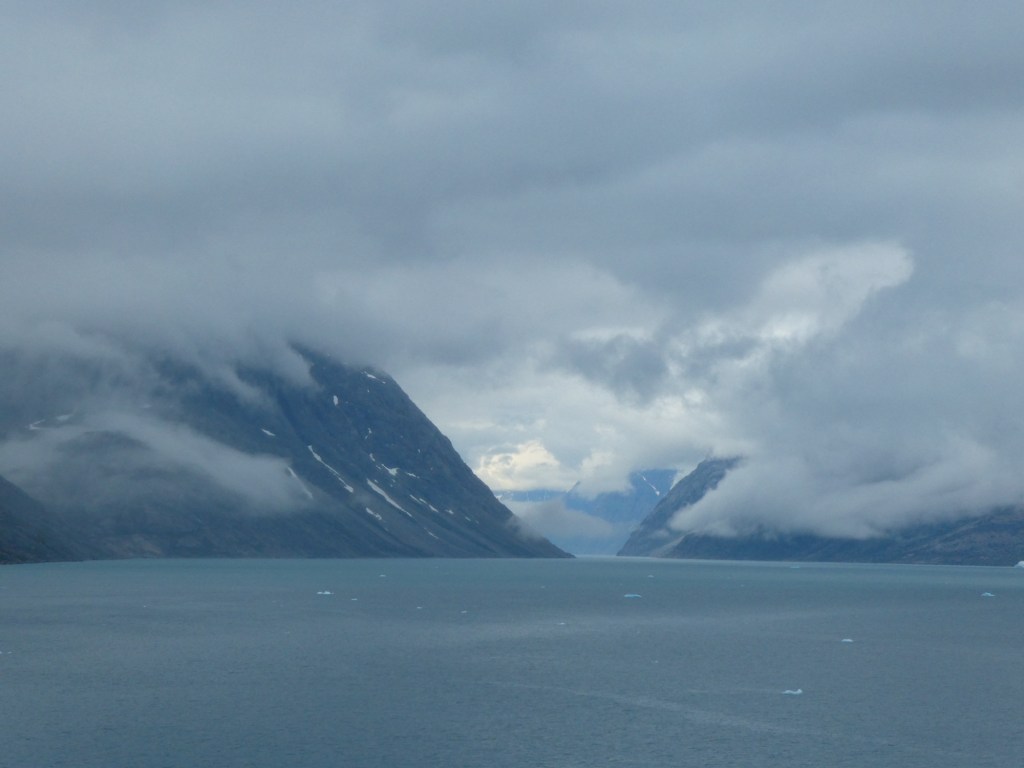
Over night the ships fog horn sounded most of the night and when we woke up, you could not see anything. We were due to sail through Prince Christian Sound. We arrived as scheduled around 10 AM. It was still foggy, but we could see. Prince Christian Sound is 60 miles long at the very southern tip of Greenland. It has many dramatic landscapes, waterfalls, glaciers, mountains and icebergs. It was damp out because of the fog, but not rainy. It never got sunny during our day but the scenery was amazing to see. One of the lecturers would give commentary as we sailed along. At one point we were able to draw close to the face of a glacier. At another point we were at the intersection of 6 different fjords. It took us about 7 hours to make the transit.
Thought we might get some sun, but it did not happen One of the many waterfalls
We played bridge again (no score yet).
We are now sailing in the open waters and watching icebergs float past us, or we are floating past them.
Tomorrow we have our first port in Greenland. Anticipating a very chilly day.
The day was warm and sunny and the waters as we left town on the harbor were like a mirror. Our guide, Heidi, said it was very rare for the water to be that still. This is probably a repeat, but Isafjordur has a population of about 2,700 and is considered the capital of the west. This part of Iceland is the oldest and has no geothermal activity. It is full of lakes, fjords and waterfalls. There are three legs to the economy here: fishing, aluminum and tourism.
There is a small airport on the edge of the fjord and pilots need a special permit to land here because of the difficult approach. There are many fences and barriers on the mountains to protect the town and inhabitants from avalanches and rock slides. The hillsides were full of summer houses, but strangely about 70% were owned by the people of the town. The reason is that they are up high and are cooler in the summer.
We found out that the people of this area are pretty wealthy. The reason is that when the company, Kerecis (remember they developed using fish skin for healing of burns) was started the people of Isafjordur were given the opportunity to become shareholders. Many years later the company was sold for 1.4 billion and that made many people very rich. A really good story.
We went through a 1 lane tunnel which was 6 kilometers long and had a branch in the middle where you could exit to get to a 3rd town. There are lots of rules about driving in a 1 lane tunnel. When it was built they found an underground waterfall that supplies several towns with water.
The oldest bookstore in Iceland is one of these small towns and when you come in to buy a book it is sold by weight. The bookstore was established in 1914. The reason the books are sold by weight is because in the old days, it cost so much to bring in a book, that the best way to price it was by weight and they have not changed in over 100 years.
Our guide explained why Icelandic lamb is the best- it grazes all summer eating all kinds of grasses and wild herbs – sort of premarinating. We also learned about the traditional Icelandic sweaters and what the different colors and designs mean.
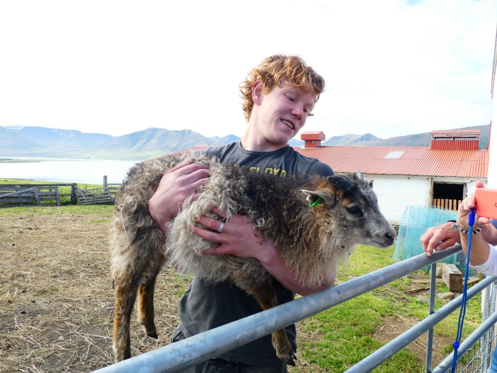
Our first stop was at a farm called Gemufall. We had drinks and traditional marriage cake. Then a young man took us to meet the horses, dogs, chicken, turkeys and of course the new lambs and their mothers. He had a fabulous sense of humor and told us very vivid stories about life on this farm.
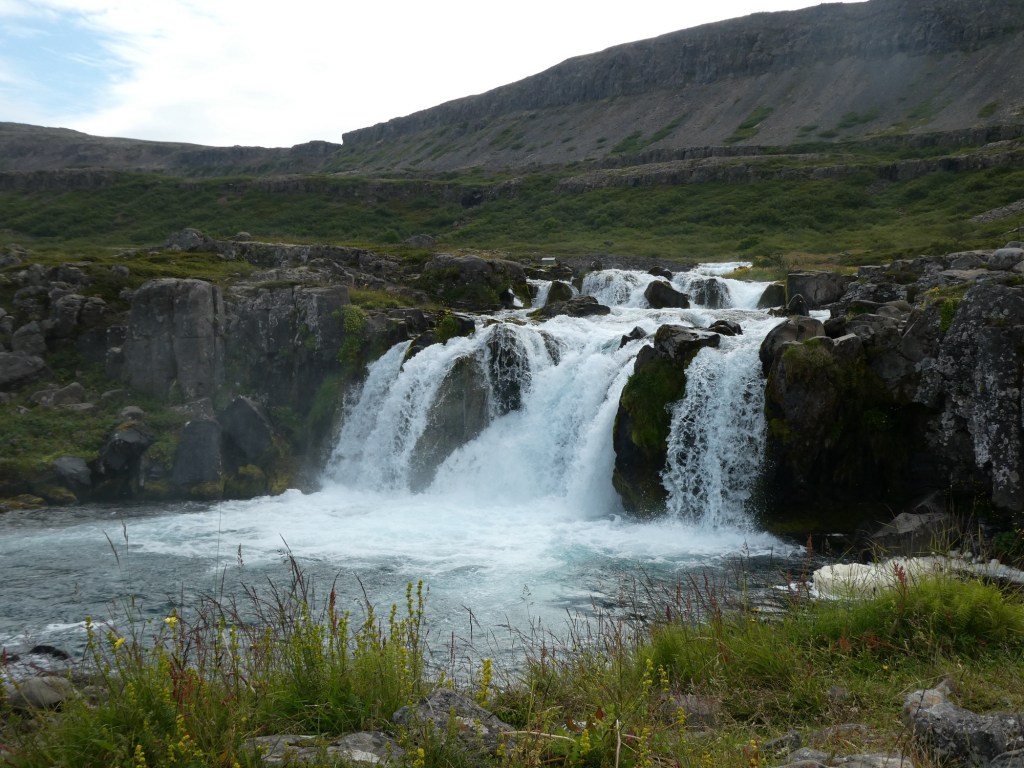
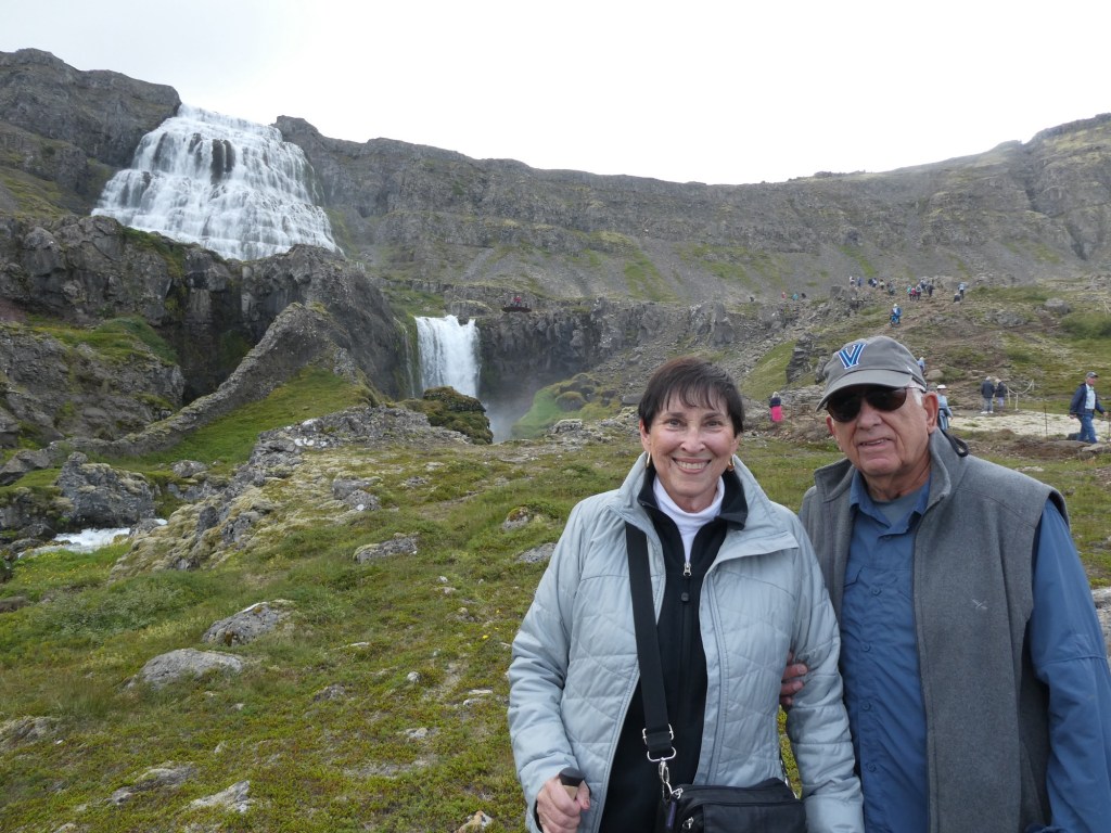
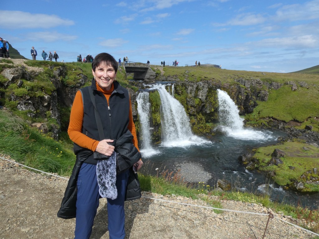
Then we were on the road again, through another 5.6 kilometer tunnel, but a regular one with 2 way traffic. Our ultimate destination was the Dynjandi Waterfall. It was amazing and not just 1 waterfall but a series of over 10. The biggest part at the top looks like a bridal veil or maybe a wedding cake. We climbed up to get closer looks. Please Google it for more professional photos, we could not get all of it with our limited photographic abilities.
One of the lower falls
It was a wonderful day; sunny, cool and fun experiences.
We arrived at this port with sunny skies and a prediction of temperatures in the high 50s. Grundarfjordur is a small village located at the end of a fjord on the north coast of the Snæfellsnes peninsula. The town is surrounded by mountains and has about 870 in population. The mountains even block the sun from mid November to mid January. When the sun reappears they have a huge party. The prime industry is fishing and the processing of the fish. Approximately 30% of the population is made up of immigrants from Venezuela. They came to avoid the persecution they faced, and to seek asylum.
The French fished in this area from the 1700s to 1900s and one of the main streets is named for the sister town in France, Paimpol.
The are 112 words for wind in Iceland and the town has a unique sculpture to show this. The sculpture goes from the lightest wind to the most severe. The word for hurricane was fourth from the top – Fellibylur.
The 112 words
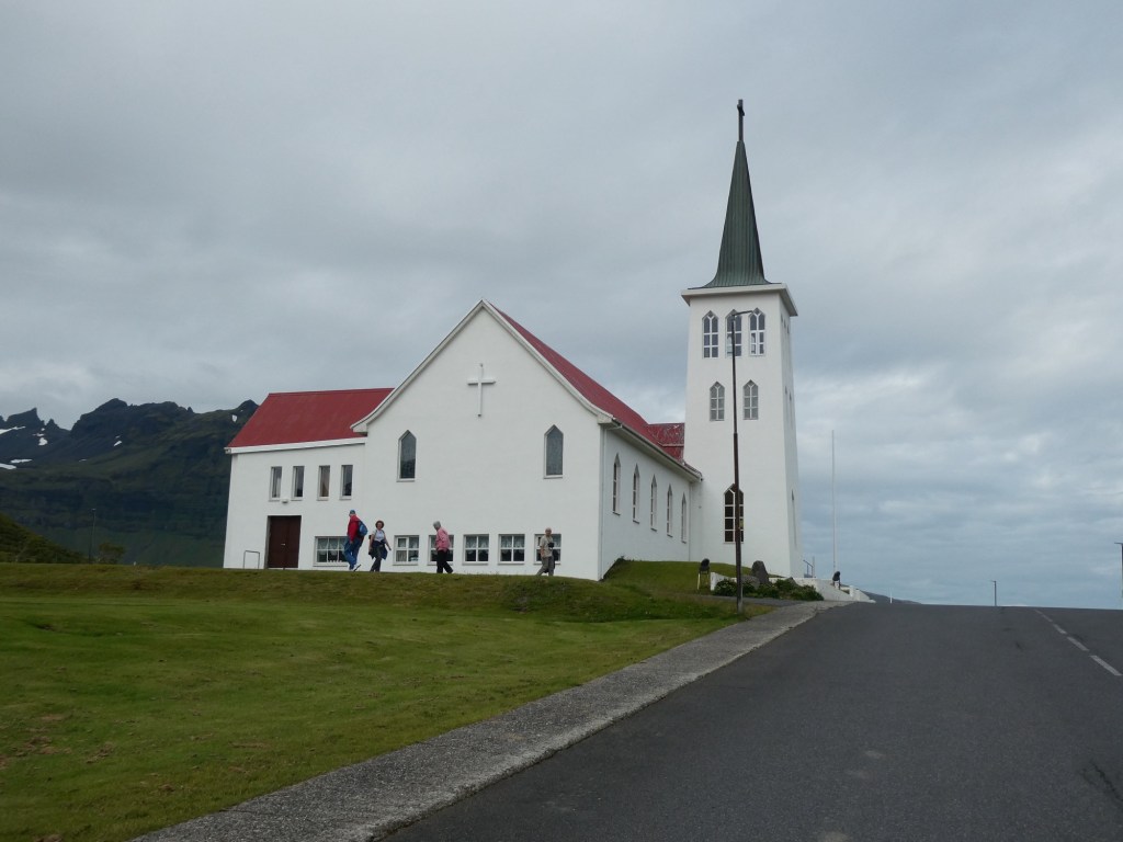
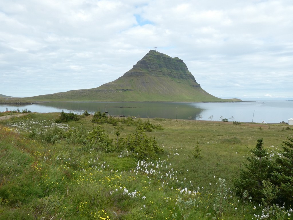
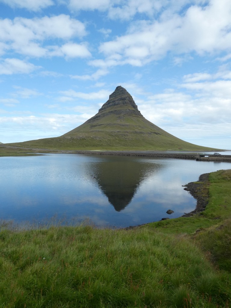
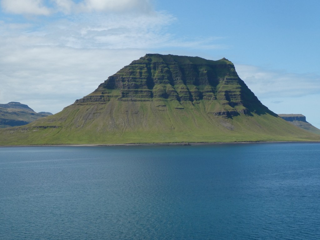
The town is famous for Kirkjufell, which means the church mountain. It is free standing and very large. It was featured in Game of Thrones and known as arrowhead in that program. It is often called the most photographed mountain in Iceland, due to the variety of different ways you can shoot it, and how different it appears under different light conditions.
Many views of the mountain Kirkjufell
Our main purpose was to hike to the waterfall whose name was not given. We walked through some forested area and then down and up and down a rocky path to the waterfall. The total round trip was about 6 miles.
It was an exhausting but rewarding day, and we earned our glass of wine with dinner.
We slept in late today with no activity planned until the afternoon. We had booked an excursion to The Lava Tunnel.. We were picked up at the hotel by a transfer bus which took us to the main bus station where we got on a minibus. Out driver, Thor, gave us information about what we were seeing on our way.
We saw the steam from their largest steam generation plant and mining of the lava from tall hillsides. The lava mined is used in the making of concrete.
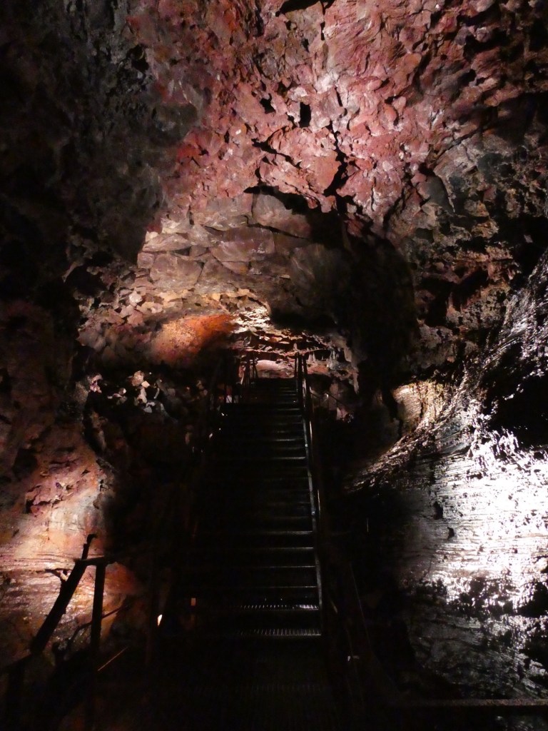
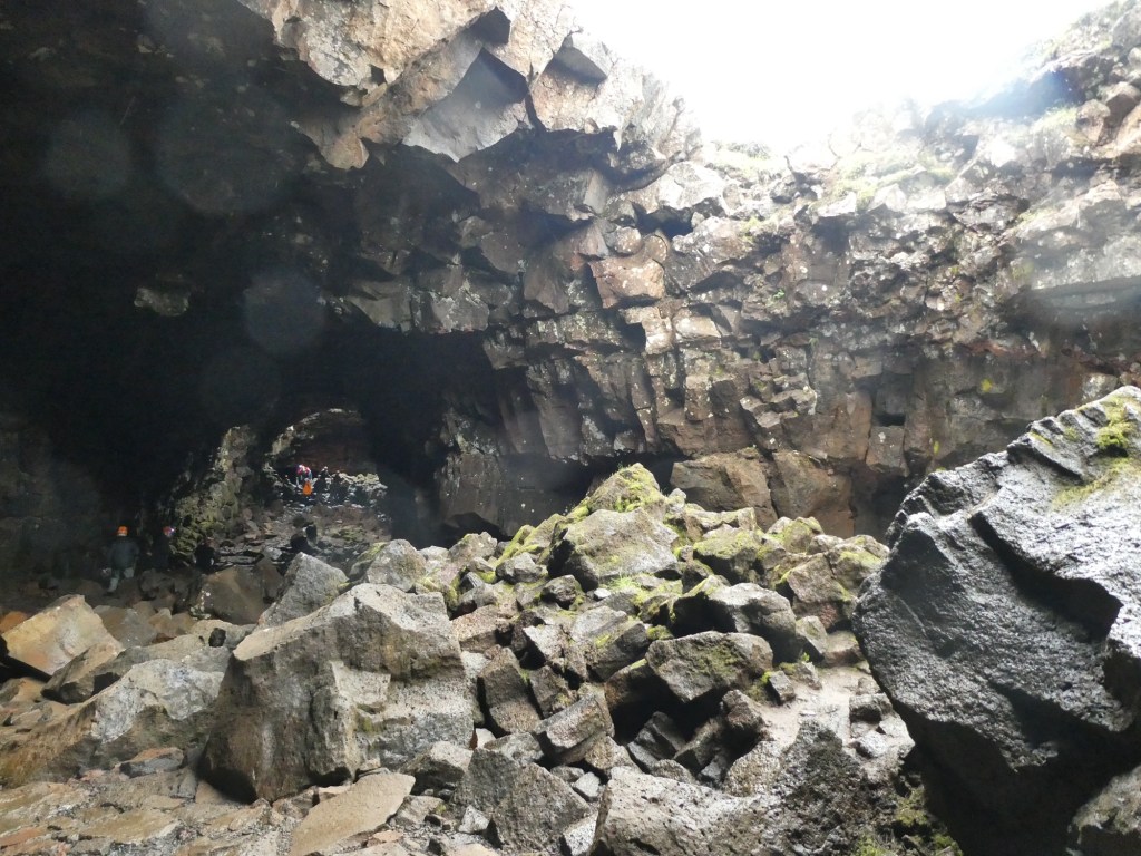
After about 45 minutes we were at the Lava Tunnel. We had a briefing and got our hard hats and walking sticks and off we went. There were areas of rocks to walk over as well as stairs and ramps. This tunnel was formed about 5,200 years ago. Our guide explained about the different colors in the rocks and the different forms in the walls. The lava river that formed this tunnel was probably 1200 degrees Celsius. Now inside the tunnel it is 4 degrees Celsius. It was cold in the tunnel and lots of water was dripping down on us. It takes about 40 years for lava to cool, so some of the recent eruptions in Iceland will not be cool until 2065 or later making the areas affected uninhabitable for a long time.
The tunnel was discovered about 120 years ago because of a “skylight” (a hole in the roof of the tunnel). The translation of the Icelandic name, Raufarhólshellir, means “cracky cave on a hill.” The tunnel walk was about 1/4 mile, with lights along the way. At the end, we stopped and our guide turned all the lights out and it was something to be in the total darkness and total quiet.
I think this is a picture of Bette at one of the staircasesThe biggest “skylight”
We were returned to the hotel to rest and freshen up. Our final stop for the day was dinner. About 10 years ago we had dinner in a restaurant in downtown Reykjavik and we had made a reservation to dine there this time. It was not a fancy restaurant but the food we remembered was great. I will report that the second time did not disappoint. The Arctic char dinner at Messinn was just as good as remembered.
Tomorrow we board Oceania Marina for the next part of our trip.


Recent Comments